
Indicator Gauge Icon Legend

Legend Colors

Red is bad, green is good, blue is not statistically different/neutral.

Compared to Distribution

an indicator guage with the arrow in the green 
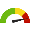
the value is in the best half of communities.

an indicator guage with the arrow in the yellow 
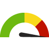
the value is in the 2nd worst quarter of communities.

an indicator guage with the arrow in the red 
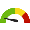
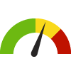
the value is in the worst quarter of communities.

Compared to Target

green circle with white tick inside it meets target; red circle with white cross inside it does not meet target.

Compared to a Single Value

green diamond with downward arrow inside it lower than the comparison value; red diamond with downward arrow inside it higher than the comparison value; blue diamond with downward arrow inside it not statistically different from comparison value.

Trend

green square outline with upward trending arrow inside it green square outline with downward trending arrow inside it non-significant change over time; green square with upward trending arrow inside it green square with downward trending arrow inside it significant change over time; blue square with equals sign no change over time.

Compared to Prior Value

green triangle with upward trending arrow inside it higher than the previous measurement period; green triangle with downward trending arrow inside it lower than the previous measurement period; blue equals sign no statistically different change  from previous measurement period.

green chart bars Significantly better than the overall value

red chart bars Significantly worse than the overall value

light blue chart bars No significant difference with the overall value

gray chart bars No data on significance available

More information about the gauges and icons

Daily Dose of UV Irradiance

Measurement Period: 2020
This indicator shows the annual average daily dose of Ultraviolet (UV) irradiance. The daily dose of UV irradiance is calculated in Joules per square meter and is averaged over a full year. UV irradiance data is calculated at the county level based on population weighted census tract values.
 
This indicator represents environmental exposures per unit area and do not directly account for personal exposures at an individual level.

Why is this important?

Ultraviolet (UV) radiation, although not visible to the human eye, is responsible for sunburns and a number of other adverse health effects, particularly for people who spend time outdoors without sun protection. These adverse health effects include skin cancer, premature aging of the skin, suppression of the immune system, and cataracts and other eye damage. The level of UV radiation that reaches earth's surface and thus can affect the health of people, can vary depending on many factors including the ozone layer thickness. As the ozone layer has thinned over time due to the release of ozone-depleting substances that have been widely used by humans in industry, the ozones ability to absorb UV radiation has decreased, increasing the risk of adverse health effects in people.
More...
5,048.0
Joule per square meter
Source: National Environmental Public Health Tracking Network
Measurement period: 2020
Maintained by: Conduent Healthy Communities Institute
Last update: October 2023

Graph Selections

Indicator Values
  • Download JPEG
  • Download PDF
  • Download CSV
  • Chart options:
  • Enable zero-based y-axis

Data Source

Filed under: Environmental Health / Weather & Climate, Physical Determinants of Health